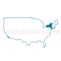
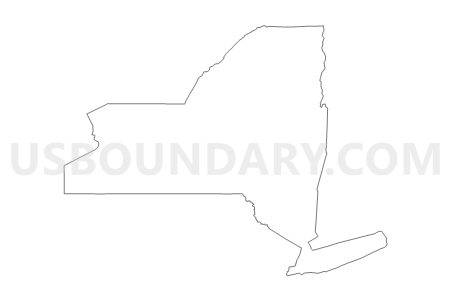
New York
About
Outline
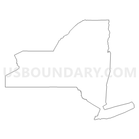
Summary
| Unique Area Identifier | 201748 |
| Name | New York |
| Area (square miles) | 54,554.97 |
| Land Area (square miles) | 47,126.40 |
| Water Area (square miles) | 7,428.58 |
| % of Land Area | 86.38 |
| % of Water Area | 13.62 |
| Latitude of the Internal Point | 42.91339740 |
| Longtitude of the Internal Point | -75.59627230 |
| Total Population | 19,378,102 |
| Total Housing Units | 8,108,103 |
| Total Households | 7,317,755 |
| Median Age | 38 |
Maps
Graphs
Select a template below for downloading or customizing gragh for New York



Neighbors
Neighoring State and Equivalent (by Name) Neighboring State and Equivalent on the Map
County in New York (by Name) Neighboring County on the Map
- Albany County, NY
- Allegany County, NY
- Bronx County, NY
- Broome County, NY
- Cattaraugus County, NY
- Cayuga County, NY
- Chautauqua County, NY
- Chemung County, NY
- Chenango County, NY
- Clinton County, NY
- Columbia County, NY
- Cortland County, NY
- Delaware County, NY
- Dutchess County, NY
- Erie County, NY
- Essex County, NY
- Franklin County, NY
- Fulton County, NY
- Genesee County, NY
- Greene County, NY
- Hamilton County, NY
- Herkimer County, NY
- Jefferson County, NY
- Kings County, NY
- Lewis County, NY
- Livingston County, NY
- Madison County, NY
- Monroe County, NY
- Montgomery County, NY
- Nassau County, NY
- New York County, NY
- Niagara County, NY
- Oneida County, NY
- Onondaga County, NY
- Ontario County, NY
- Orange County, NY
- Orleans County, NY
- Oswego County, NY
- Otsego County, NY
- Putnam County, NY
- Queens County, NY
- Rensselaer County, NY
- Richmond County, NY
- Rockland County, NY
- Saratoga County, NY
- Schenectady County, NY
- Schoharie County, NY
- Schuyler County, NY
- Seneca County, NY
- St. Lawrence County, NY
- Steuben County, NY
- Suffolk County, NY
- Sullivan County, NY
- Tioga County, NY
- Tompkins County, NY
- Ulster County, NY
- Warren County, NY
- Washington County, NY
- Wayne County, NY
- Westchester County, NY
- Wyoming County, NY
- Yates County, NY
Top 10 County Subdivision in New York (by Population) Neighboring County Subdivision on the Map
- Brooklyn borough, Kings County, NY (2,504,700)
- Queens borough, Queens County, NY (2,230,722)
- Manhattan borough, New York County, NY (1,585,873)
- Bronx borough, Bronx County, NY (1,385,108)
- Hempstead town, Nassau County, NY (759,757)
- Brookhaven town, Suffolk County, NY (486,040)
- Staten Island borough, Richmond County, NY (468,730)
- Islip town, Suffolk County, NY (335,543)
- Oyster Bay town, Nassau County, NY (293,214)
- Buffalo city, Erie County, NY (261,310)
Top 10 Place in New York (by Population) Neighboring Place on the Map
- New York city, NY (8,175,133)
- Buffalo city, NY (261,310)
- Rochester city, NY (210,565)
- Yonkers city, NY (195,976)
- Syracuse city, NY (145,170)
- Albany city, NY (97,856)
- New Rochelle city, NY (77,062)
- Cheektowaga CDP, NY (75,178)
- Mount Vernon city, NY (67,292)
- Schenectady city, NY (66,135)
Top 10 Elementary School District in New York (by Population) Neighboring Elementary School District on the Map
- Elmont Union Free School District, NY (50,010)
- Valley Stream Union Free School District 13, NY (28,276)
- North Bellmore Union Free School District, NY (26,085)
- Franklin Square Union Free School District, NY (25,069)
- New Hyde Park-Garden City Park Union Free School District, NY (22,808)
- Floral Park-Bellerose Union Free School District, NY (20,078)
- Merrick Union Free School District, NY (17,964)
- Valley Stream Union Free School District 30, NY (17,623)
- North Merrick Union Free School District, NY (14,055)
- Valley Stream Union Free School District 24, NY (13,866)
Top 10 Secondary School District in New York (by Population) Neighboring Secondary School District on the Map
- Sewanhaka Central High School District, NY (117,965)
- Bellmore-Merrick Central High School District, NY (70,643)
- Valley Stream Central High School District, NY (59,765)
Top 10 Unified School District in New York (by Population) Neighboring Unified School District on the Map
- New York City Department Of Education, NY (8,175,133)
- Buffalo City School District, NY (261,310)
- Rochester City School District, NY (210,596)
- Yonkers City School District, NY (195,976)
- Syracuse City School District, NY (145,259)
- East Ramapo Central School District, NY (113,031)
- Albany City School District, NY (97,839)
- Brentwood Union Free School District, NY (87,253)
- Sachem Central School District, NY (83,196)
- Greece Central School District, NY (82,633)
Top 10 State Legislative District Lower Chamber in New York (by Population) Neighboring State Legislative District Lower Chamber on the Map
- Assembly District 1, NY (149,382)
- Assembly District 75, NY (149,377)
- Assembly District 95, NY (145,915)
- Assembly District 6, NY (145,372)
- Assembly District 97, NY (144,514)
- Assembly District 3, NY (143,108)
- Assembly District 2, NY (142,833)
- Assembly District 100, NY (140,947)
- Assembly District 66, NY (140,310)
- Assembly District 79, NY (139,940)
Top 10 State Legislative District Upper Chamber in New York (by Population) Neighboring State Legislative District Upper Chamber on the Map
- State Senate District 38, NY (347,376)
- State Senate District 17, NY (341,278)
- State Senate District 1, NY (341,254)
- State Senate District 25, NY (335,683)
- State Senate District 32, NY (333,737)
- State Senate District 29, NY (333,345)
- State Senate District 23, NY (332,657)
- State Senate District 39, NY (332,117)
- State Senate District 36, NY (328,256)
- State Senate District 37, NY (326,645)
Top 10 111th Congressional District in New York (by Population) Neighboring 111th Congressional District on the Map
- Congressional District 8, NY (713,512)
- Congressional District 1, NY (705,559)
- Congressional District 19, NY (699,959)
- Congressional District 16, NY (693,819)
- Congressional District 13, NY (686,525)
- Congressional District 20, NY (683,198)
- Congressional District 2, NY (679,893)
- Congressional District 22, NY (679,297)
- Congressional District 21, NY (679,193)
- Congressional District 17, NY (678,558)
Top 10 Census Tract in New York (by Population) Neighboring Census Tract on the Map
- Census Tract 462.01, Bronx County, NY (26,588)
- Census Tract 44, New York County, NY (16,538)
- Census Tract 136, New York County, NY (15,344)
- Census Tract 245, New York County, NY (14,934)
- Census Tract 154, New York County, NY (13,749)
- Census Tract 40, Richmond County, NY (12,998)
- Census Tract 126, New York County, NY (12,774)
- Census Tract 334.02, Queens County, NY (12,575)
- Census Tract 138, New York County, NY (12,444)
- Census Tract 455, Queens County, NY (12,330)
Top 10 5-Digit ZIP Code Tabulation Area in New York (by Population) Neighboring 5-Digit ZIP Code Tabulation Area on the Map
- 11368, NY (109,931)
- 11226, NY (101,572)
- 11373, NY (100,820)
- 11220, NY (99,598)
- 11385, NY (98,592)
- 10467, NY (97,060)
- 10025, NY (94,600)
- 11208, NY (94,469)
- 11236, NY (93,877)
- 11207, NY (93,386)
Data
Demographic, Population, Households, and Housing Units
** Data sources from census 2010 **
Show Data on Map
Download Full List as CSV
Download Quick Sheet as CSV
| Subject | This Area | National |
|---|---|---|
| POPULATION | ||
| Total Population Map | 19,378,102 | 308,745,538 |
| POPULATION, HISPANIC OR LATINO ORIGIN | ||
| Not Hispanic or Latino Map | 15,961,180 | 258,267,944 |
| Hispanic or Latino Map | 3,416,922 | 50,477,594 |
| POPULATION, RACE | ||
| White alone Map | 12,740,974 | 223,553,265 |
| Black or African American alone Map | 3,073,800 | 38,929,319 |
| American Indian and Alaska Native alone Map | 106,906 | 2,932,248 |
| Asian alone Map | 1,420,244 | 14,674,252 |
| Native Hawaiian and Other Pacific Islander alone Map | 8,766 | 540,013 |
| Some Other Race alone Map | 1,441,563 | 19,107,368 |
| Two or More Races Map | 585,849 | 9,009,073 |
| POPULATION, SEX | ||
| Male Map | 9,377,147 | 151,781,326 |
| Female Map | 10,000,955 | 156,964,212 |
| POPULATION, AGE (18 YEARS) | ||
| 18 years and over Map | 15,053,173 | 234,564,071 |
| Under 18 years | 4,324,929 | 74,181,467 |
| POPULATION, AGE | ||
| Under 5 years | 1,155,822 | 20,201,362 |
| 5 to 9 years | 1,163,955 | 20,348,657 |
| 10 to 14 years | 1,211,456 | 20,677,194 |
| 15 to 17 years | 793,696 | 12,954,254 |
| 18 and 19 years | 572,582 | 9,086,089 |
| 20 years | 293,083 | 4,519,129 |
| 21 years | 281,596 | 4,354,294 |
| 22 to 24 years | 836,256 | 12,712,576 |
| 25 to 29 years | 1,380,177 | 21,101,849 |
| 30 to 34 years | 1,279,160 | 19,962,099 |
| 35 to 39 years | 1,254,124 | 20,179,642 |
| 40 to 44 years | 1,355,893 | 20,890,964 |
| 45 to 49 years | 1,458,763 | 22,708,591 |
| 50 to 54 years | 1,419,928 | 22,298,125 |
| 55 to 59 years | 1,237,408 | 19,664,805 |
| 60 and 61 years | 453,993 | 7,113,727 |
| 62 to 64 years | 612,267 | 9,704,197 |
| 65 and 66 years | 330,160 | 5,319,902 |
| 67 to 69 years | 443,051 | 7,115,361 |
| 70 to 74 years | 587,391 | 9,278,166 |
| 75 to 79 years | 474,807 | 7,317,795 |
| 80 to 84 years | 391,660 | 5,743,327 |
| 85 years and over | 390,874 | 5,493,433 |
| MEDIAN AGE BY SEX | ||
| Both sexes Map | 38.00 | 37.20 |
| Male Map | 36.30 | 35.80 |
| Female Map | 39.40 | 38.50 |
| HOUSEHOLDS | ||
| Total Households Map | 7,317,755 | 116,716,292 |
| HOUSEHOLDS, HOUSEHOLD TYPE | ||
| Family households: Map | 4,649,791 | 77,538,296 |
| Husband-wife family Map | 3,192,903 | 56,510,377 |
| Other family: Map | 1,456,888 | 21,027,919 |
| Male householder, no wife present Map | 366,948 | 5,777,570 |
| Female householder, no husband present Map | 1,089,940 | 15,250,349 |
| Nonfamily households: Map | 2,667,964 | 39,177,996 |
| Householder living alone Map | 2,130,670 | 31,204,909 |
| Householder not living alone Map | 537,294 | 7,973,087 |
| HOUSEHOLDS, HISPANIC OR LATINO ORIGIN OF HOUSEHOLDER | ||
| Not Hispanic or Latino householder: Map | 6,311,241 | 103,254,926 |
| Hispanic or Latino householder: Map | 1,006,514 | 13,461,366 |
| HOUSEHOLDS, RACE OF HOUSEHOLDER | ||
| Householder who is White alone | 5,169,163 | 89,754,352 |
| Householder who is Black or African American alone | 1,095,790 | 14,129,983 |
| Householder who is American Indian and Alaska Native alone | 33,824 | 939,707 |
| Householder who is Asian alone | 445,652 | 4,632,164 |
| Householder who is Native Hawaiian and Other Pacific Islander alone | 2,615 | 143,932 |
| Householder who is Some Other Race alone | 405,320 | 4,916,427 |
| Householder who is Two or More Races | 165,391 | 2,199,727 |
| HOUSEHOLDS, HOUSEHOLD TYPE BY HOUSEHOLD SIZE | ||
| Family households: Map | 4,649,791 | 77,538,296 |
| 2-person household Map | 1,785,206 | 31,882,616 |
| 3-person household Map | 1,109,716 | 17,765,829 |
| 4-person household Map | 944,590 | 15,214,075 |
| 5-person household Map | 461,667 | 7,411,997 |
| 6-person household Map | 189,577 | 3,026,278 |
| 7-or-more-person household Map | 159,035 | 2,237,501 |
| Nonfamily households: Map | 2,667,964 | 39,177,996 |
| 1-person household Map | 2,130,670 | 31,204,909 |
| 2-person household Map | 430,564 | 6,360,012 |
| 3-person household Map | 66,787 | 992,156 |
| 4-person household Map | 24,877 | 411,171 |
| 5-person household Map | 8,596 | 126,634 |
| 6-person household Map | 3,400 | 48,421 |
| 7-or-more-person household Map | 3,070 | 34,693 |
| HOUSING UNITS | ||
| Total Housing Units Map | 8,108,103 | 131,704,730 |
| HOUSING UNITS, OCCUPANCY STATUS | ||
| Occupied Map | 7,317,755 | 116,716,292 |
| Vacant Map | 790,348 | 14,988,438 |
| HOUSING UNITS, OCCUPIED, TENURE | ||
| Owned with a mortgage or a loan Map | 2,610,123 | 52,979,430 |
| Owned free and clear Map | 1,287,714 | 23,006,644 |
| Renter occupied Map | 3,419,918 | 40,730,218 |
| HOUSING UNITS, VACANT, VACANCY STATUS | ||
| For rent Map | 200,039 | 4,137,567 |
| Rented, not occupied Map | 12,786 | 206,825 |
| For sale only Map | 77,225 | 1,896,796 |
| Sold, not occupied Map | 21,027 | 421,032 |
| For seasonal, recreational, or occasional use Map | 289,301 | 4,649,298 |
| For migrant workers Map | 892 | 24,161 |
| Other vacant Map | 189,078 | 3,652,759 |
| HOUSING UNITS, OCCUPIED, AVERAGE HOUSEHOLD SIZE BY TENURE | ||
| Total: Map | 2.57 | 2.58 |
| Owner occupied Map | 2.71 | 2.65 |
| Renter occupied Map | 2.41 | 2.44 |
| HOUSING UNITS, OCCUPIED, TENURE BY RACE OF HOUSEHOLDER | ||
| Owner occupied: Map | 3,897,837 | 75,986,074 |
| Householder who is White alone Map | 3,237,592 | 63,446,275 |
| Householder who is Black or African American alone Map | 325,395 | 6,261,464 |
| Householder who is American Indian and Alaska Native alone Map | 11,250 | 509,588 |
| Householder who is Asian alone Map | 197,011 | 2,688,861 |
| Householder who is Native Hawaiian and Other Pacific Islander alone Map | 741 | 61,911 |
| Householder who is Some Other Race alone Map | 74,243 | 1,975,817 |
| Householder who is Two or More Races Map | 51,605 | 1,042,158 |
| Renter occupied: Map | 3,419,918 | 40,730,218 |
| Householder who is White alone Map | 1,931,571 | 26,308,077 |
| Householder who is Black or African American alone Map | 770,395 | 7,868,519 |
| Householder who is American Indian and Alaska Native alone Map | 22,574 | 430,119 |
| Householder who is Asian alone Map | 248,641 | 1,943,303 |
| Householder who is Native Hawaiian and Other Pacific Islander alone Map | 1,874 | 82,021 |
| Householder who is Some Other Race alone Map | 331,077 | 2,940,610 |
| Householder who is Two or More Races Map | 113,786 | 1,157,569 |
| HOUSING UNITS, OCCUPIED, TENURE BY HISPANIC OR LATINO ORIGIN OF HOUSEHOLDER | ||
| Owner occupied: Map | 3,897,837 | 75,986,074 |
| Not Hispanic or Latino householder Map | 3,664,784 | 69,617,625 |
| Hispanic or Latino householder Map | 233,053 | 6,368,449 |
| Renter occupied: Map | 3,419,918 | 40,730,218 |
| Not Hispanic or Latino householder Map | 2,646,457 | 33,637,301 |
| Hispanic or Latino householder Map | 773,461 | 7,092,917 |
| HOUSING UNITS, OCCUPIED, TENURE BY HOUSEHOLD SIZE | ||
| Owner occupied: Map | 3,897,837 | 75,986,074 |
| 1-person household Map | 860,611 | 16,453,569 |
| 2-person household Map | 1,304,752 | 27,618,605 |
| 3-person household Map | 660,251 | 12,517,563 |
| 4-person household Map | 606,580 | 10,998,793 |
| 5-person household Map | 279,929 | 5,057,765 |
| 6-person household Map | 106,323 | 1,965,796 |
| 7-or-more-person household Map | 79,391 | 1,373,983 |
| Renter occupied: Map | 3,419,918 | 40,730,218 |
| 1-person household Map | 1,270,059 | 14,751,340 |
| 2-person household Map | 911,018 | 10,624,023 |
| 3-person household Map | 516,252 | 6,240,422 |
| 4-person household Map | 362,887 | 4,626,453 |
| 5-person household Map | 190,334 | 2,480,866 |
| 6-person household Map | 86,654 | 1,108,903 |
| 7-or-more-person household Map | 82,714 | 898,211 |
Loading...


